


California has experienced rainstorms in the last couple of weeks, but these most likely have nothing to do with the predicted El Niño, said Cindy Bean, a meteorologist at the National Weather Service in Hanford.
The storms, which hit the Valley last Monday and will hit again this week, are more typical of the normal winter conditions that come from the Gulf of Alaska. The El Niño Southern Oscillation, commonly called ENSO or El Niño, generally affects the jet stream in the Southern Pacific Ocean more than the North Pacific Ocean jet stream, because these past storms have been coming from the north they are likely not related to El Niño, explained Bean.
“El Niño just refers to the warm ocean water that can influence the atmosphere which has the potential for getting more storms from the south,” Bean said. Because the oceans and the atmosphere are always interacting, so it can drive the weather systems by changes in the ocean temperature.”
El Niño is a part of the cyclic nature of the Pacific Oceans and although it occurs in the Pacific Ocean, it can affect climate worldwide, said Peter Van de Water, associate professor of the department of earth & environmental sciences.
The phenomenon, which was first noted by fisherman off the coast of what is now called South America, is the reversal of neutral conditions in the equatorial area of the pacific ocean, whose winds blow along the equator from east to west because of the rotation of the earth, Van de Water explained.
“When those winds are pushing toward the west it actually pulls nutrient rich waters out along the Central America region and that’s perfect for feeding the food chain,” Van De Water said. “In neutral conditions we tend to get lots of fish and seafood products in and around the Pacific Coast from South America to [Southern California].”
During El Niño there is a reversal of the winds, so the winds weaken on the eastern side of the Pacific. The waters that are not being blown to the west warm and form a cap over the top of the ocean surfaces, explained Van de Water.
“The cap over the ocean surface provides warm water for evaporation and we end up with a low pressure system over the top of Central America that feeds moisture in,” explained Van de Water. “We tend to get lots of rain storms coming across Central America, Mexico, and then it will start to affect California.”
During late spring and the summer, scientists began to see characteristics of the El Niño start to build, including record sea surface temperatures off of the central Pacific Coast.
“That means there is the juice there to cause lots of evaporation and out lots of moisture into the atmosphere and get significant amount of rainfall out of this,” Van de Water said. “In fact this particular El Niño looks to be one of the strongest we’ve ever observed.”
But predicting whether or not the El Niño will bring in a wetter than normal winter isn’t exact science.
“The trend is for El Niños to bring higher than average rainfall but in the past we have had El Niños that have gave us below average precipitation and El Niños that have gave us lots of rainfall,” Van de Water said.
Generally for central California the greatest effects of an El Niño are felt during the winter months mostly January through February and sometimes through March. Meteorologist will not know if this El Niño will provide a wetter than normal winter until it hits, or until they begin to see signs that storms are coming from the South. As of now they are not seeing that indication yet, Bean said.
Even if there is above average rainfall, it will not indicate California is in the clear with the drought — it may provide some relief in the shorter term but it won’t be a culminating answer.
“We probably need twice our normal rainfall for the winter and that is not going likely going to happen,” Bean said. “We may even need more than that to actually end the drought and even receiving this much amount of rainfall would only help if the precipitation remained continuous.”
The National Oceanic and Atmospheric Administration’s Climate Prediction Center’s outlook is calling for a good chance of an above normal winter for rainfall but California is in need of snowpack.
“One of the things will El Niño is because it tends to influence the systems coming from the south those tend to be warmer systems,” Bean said. “The snow level tend to be much higher, which doesn’t necessarily give us the snow pack that we may want to have to sustain us through the summer with the snow melt into the reservoirs.”
The higher snow levels southern storms do not produce much snow in the Northern Sierras, where it is needed, because that feeds a lot of the water for California, Bean said. The storms that produce the needed snowpack are those with cooler air, which drop out of the Northwest, the Gulf of Alaska.
“If they have enough moisture to produce the snow then the snow levels will tend to be lower and we get more snow from those systems due to the cold nature of the storms,” Bean said.
The storm system, which will produce rain this week, has snow levels dropping as low as 4,000 feet.
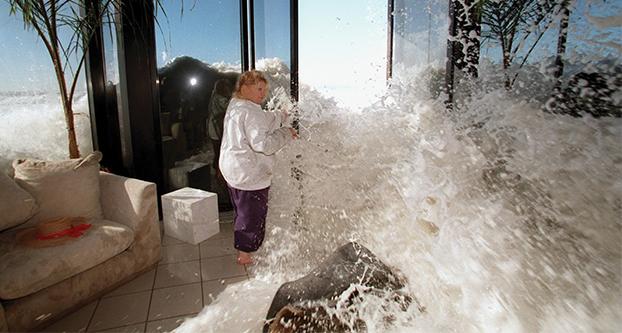
If the predictions of heavy rain are correct the El Niño produced rain can surpass what infrastructures were built for and exceed the heights of the roads causing floods and objects to wash out.
“Areas which usually get significantly affected are places in where there have been large forest fires because basically it has taken all the vegetation off and it’s loose soil waiting to flow and be washed out and down,” Van de Water said. “There is planning that is already going on for potential of large mudslides.”
Fresno State began preparing for the predicted influx of water many months before the winter.
To prevent the parking lots and sidewalks to overflow a drainage system was implemented in the 90s, which has been routinely maintained.
“We already have a good drain system, our challenge is keeping it clear of leaves, so if the drain inlets get clogged then we have a challenge,” said Rick Finden, director of Plant Operations. “We are making sure our street sweepers are working so that we can get those leaves out of the way because if we don’t the drains will clog up and that will be the big problem.”
Low spots on campus that can easily flood, like the Science I building and the Residence Dining Hall, have also began to be identified. Drains will be installed in these locations to prevent any issues.
Fresno State also invested about $250,000 for new controllers in the entire campus, so the water can be turned off at a flick of a switch if it is going to rain instead of having to change every irrigation controller by hand.
Reflectors and reflectorized paint will also be added to Barstow Avenue near the agriculture farms.
“That is one things that we have taken seriously into consideration that we will put rectors out there so it can help when it’s dark and wet out so you can see where the road is to prevent accidents so you don’t drift into the other lane or off the road,” Finden said.