Did you know there is a tool that can measure how many trees you’ll encounter on your way to the park?
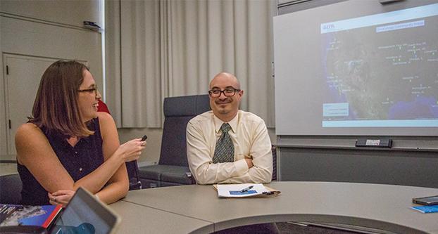
The Environmental Protection Agency’s Office of Research and Development stopped by Fresno State on Tuesday to showcase the EnviroAtlas tool, a web-based collection of interactive tools and resources that provides data, research and analysis among humans, nature, health and the economy. It can be utilized by states, communities and citizens to become better informed when creating policies and planning decisions that impact where people live, work, learn and play.
Students, staff and faculty had the opportunity to get acquainted with the map tool twice throughout the day. A morning showcase was in the Henry Madden Library, and the afternoon showcase was held at Grosse Industrial Technology Building.
The map tool is formatted through a process of layering. Layers can be added to zero in on demographics, such as the age groups who have a walking distance to parks two miles or less in west Fresno.
Health risks and benefits can also be assessed through the map. Pollution in the chosen mapped area is measured, and it displays health effects.
Data from Fresno was shared, such as walking distance to parks, tree coverage along walkable roads, commute times and urban heat island mitigation.
Users of the map tool can explore more than 100 fine-scale maps of the greater Fresno area and also more than 300 maps of the U.S.
José L. Zambrana Jr., senior science adviser at the EPA’s Immediate Office of the Assistant Administrator and the Office of Research and Development, said the tool showcases how the EPA is using “science to support communities.”
“We are really challenged every day about how we can help the environment through the decisions that we make personally, [through] your community, mayor and city council, organizations, builders and planners,” Zambrana said. “[They can] make decisions that can help the environment.”
He said the goal of the map tool is to provide decision-support tools using web-based data. The creation of the tool was a collaborative effort with various government agencies and universities.
Jessica Daniel, environmental protection specialist, said: “We center on the concept of ecosystem goods and services. The reason we do that is because the benefits we get from nature are all intertwined.”
The interactive mapping application has two scales. The first is a national scale with more than 200 national data layers. The second scale is for select communities, including Fresno, which was one of the first communities to be mapped, according to Daniel.
Fresno has more than 100 informational data layers that are available for access through the interactive map.
Aristides Aguilera Figueroa took a special interest in the showcase because he is currently earning his Geographic Informations Systems certificate through the university’s Geography and City and Regional Planning department.
Figueroa said, “EnviroAtlas shares similarities to ArcGis [which is] the software we use in the lab, so I thought I should check it out.”
He added that the power of information needs to be explored.
“One day, I have a vision of interdisciplinary collaborations using information technology software for the well-being of communities and regions throughout the world,” Figueroa said.
The event was sponsored by the university’s Department of Recreation Administration’s Sustainable Parks and Recreation Community Initiative (SPARCI) program.
The tool is free to use on the EPA’s website at www.epa.gov/enviroatlas.


