By Jordan Nicholson
In The Sierras, right in our own backyard, there are some pretty incredible trails, full of wildlife, rivers and dense forests.
You want to call yourself a hiker and be a part of this crazy outdoor goodness? All you have to do is ignore your Twitter feed, silence your iPhone and put down the frothy Dutch Bros. Coffee latte. Instead, grab your hiking boots, plenty of water and get yourself moving.
If you don’t mind taking a little drive up into the mountains over the weekend, I recommend the Lewis Creek Trail in Oakhurst. This is a well-known trail among mountain-dwellers and it’s a hike I used to do weekly when I was in high school. For folks down here in Fresno, it is a fantastic opportunity to get out of town for the day and enjoy nature.
I first found this trail when I was on my way to the Yosemite National Park. I noticed the trailhead sign on the side of Highway 41 and remembered hearing about good bouldering spots on the trail. So, being a bit of a rock lover I pulled over and expected to do a little bouldering.
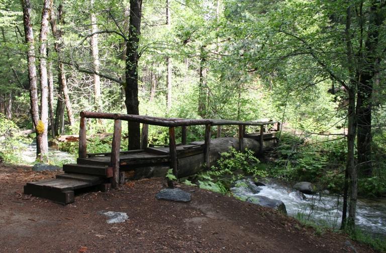
I headed down the slope at the start of the trailhead and found more than just a few climbable boulders instead I found a gorgeous trail with bridges and a rushing river (blame the drought for the creek you may find there now). Regardless, the scenery is absolutely beautiful, and let’s just say I forgot about the climbing.
The trail overall is relatively level with moments of incline. It is well-kept and hosts a couple of different waterfalls along the way. First, you can hike to Corlieu Falls, which goes off to the right of the trail shortly. Come back the same way, go left and continue on to Red Rock Falls. There are side trails you could always take as well, so don’t be afraid to explore.
Expect to hike a little over three miles for this one. The trail is lengthy enough to feel like you’ve had a good workout and covered some ground so that’s a plus. If you’re a climber, it will also be an opportunity to explore the trail’s boulders and you can make a day of it.
Travel north on Highway 41 toward Oakhurst. After you drive through town and pass the Bass Lake turnoff, it will be roughly three miles from that point. The trailhead will be on the right and is marked by a sign and open parking lot. Park there and start the hike.
I’d rate this hike as easy to moderate, so be sure to wear sturdy shoes and bring plenty of water. I’d also recommend bringing mosquito repellent. If that’s not your thing, no worries. Just tell those mosquitoes to take a hike too and don’t forget to enjoy the day regardless of how many bites you may get.
Distance: 3.1 miles
Duration: 2-3 hours
Skill Level: Easy to moderate
Elevation Gain: 300 feet


